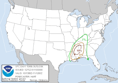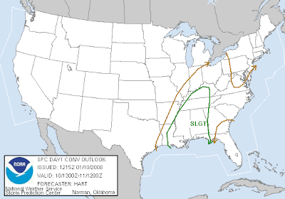

In a nutshell, the SPC continued with the slight risk. Again, they are concerned about the amouunt of cloud cover and daytime heating. Vertical shear is strong so if there are breaks in the clouds, they might have to increase to a moderate risk.
PRESENT INDICATIONS ARE THAT THESE STORMS WILL LIKELY
INCLUDE SCATTERED SUPERCELLS CAPABLE OF TORNADOES AND DAMAGING
WINDS.  MODEL GUIDANCE SUGGESTS THAT EXTENSIVE LOW CLOUDS WILL LIMIT
DAYTIME HEATING AND DESTABILIZATION.  HOWEVER...IF BREAKS IN THE
CLOUDS CAN DEVELOP...AN UPGRADE TO MODERATE RISK COULD BE REQUIRED
DUE TO STRONG NATURE OF THE SHEAR PROFILES.  ACTIVITY IS EXPECTED TO
CONTINUE TO INCREASE IN ORGANIZATION AND INTENSITY AS STORMS TRACK
EASTWARD ACROSS MS INTO AL AND FL PANHANDLE DURING THE
EVENING/NIGHT.


2 comments:
This might get interesting.
Yes indeed....I seem to be in the bull's eye...
Post a Comment