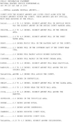
Click above to read NWS Birmingham accumulation summary.
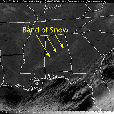
Snow accumulations were seen on satellite the next morning.

On Saturday January 19, 2008 Central Alabama enjoyed a rare snowfall. I have posted some of my photos from Coosa and Chilton counties below. There are also links to a video of ABC 33/40's coverage of the event and slideshows of images compiled by ABC 33/40 Chief meteorologist James Spann.
The white line on the snowfall accumulation map is the route my boys and I took to see snow.
The Birmingham NWS has put together a page about the event.


No comments:
Post a Comment